Historic Information
For centuries, sheep were raised on uninhabited islands where they could roam freely without fencing and predators. After breeding season, the Ram Island was likely used to segregate male sheep from the ewes on neighboring Fisherman’s Island, a mere 165 feet away. These two islands, and nearby Hypocrites ledges, were navigational hazards for vessels entering the easterly passage into Boothbay Harbor. Protests from local fishermen and ship captains resulted in the federal government purchasing Ram Island in 1837 for $195. However, construction of the lighthouse never took place until 1883 when President Chester A. Arthur approved an appropriation of $45,000.

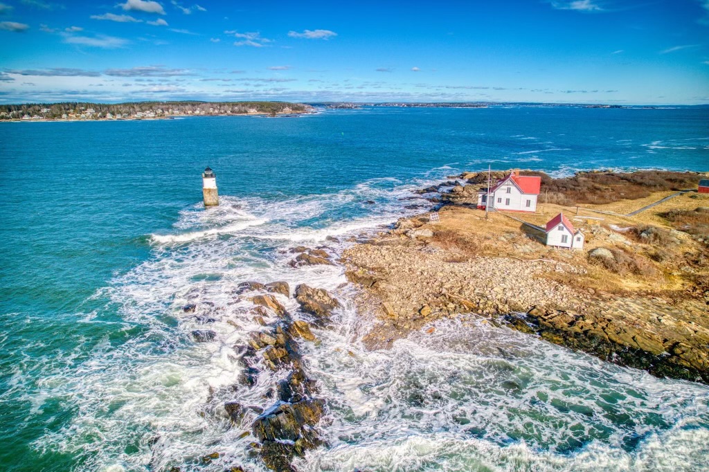
The four-acre Ram Island is located off from Boothbay’s Linekin Neck and visible off from Ocean Point. (Courtesy of Boothbay Region Historical Society)

This 1882 drawing shows a covered walkway to the tower, which was never built. This open passageway must’ve created many hardships for the keeper having to traverse it several times a day during winter and stormy weather. (Courtesy of U.S. Coast Guard)

This photo was taken in 1977 after the Coast Guard repointed the granite base, rebuilt brick portion of the cylindrical tower, and restored the cast-iron lantern. At this time, they also dismantled the deteriorated walkway and removed the rusted, metal supports pictured here. (Courtesy of U.S. Coast Guard)


The early U.S. Lighthouse Service map to the left shows two, red sectors that created a red light as safe passageways to Ram Island. Today, the opposite exists where two white sectors serve as safe fairways and they are built into the lens as shown above.
Then & Now – What Changes Have Occurred ?

Samuel J. Cavanor lit Ram Island’s lighthouse for the first time on November 5, 1883. Prior to becoming a keeper, he was aboard the lighthouse tender Iris, when a buoy hauling accident crushed his leg. Pictured here standing on nearby Fisherman’s Island, you can see Cavanor’s peg leg. (Courtesy of Boothbay Region Historical Society)

Located 280 feet from the tower, the 1883 construction included a two-story, wood-framed keeper’s dwelling that was reported as being painted white with a red roof. Other structures built at that time included a shed, outhouse, and boathouse with railways on the shore that faces Fisherman’s Island.

The site of the lighthouse is on a rock outcropping four feet below the high water mark. The tower’s granite base is topped by brick and capped by the cast-iron lantern. The beacon is connected to the island by a 214 foot-long walkway comprised of five sections supported by iron piers. (Courtesy of Boothbay Region Historical Society)

The Grand Banks Schooner Museum Trust now owns the Ram Island Light Station, through a 1998 transfer as part of the Maine Lights Program. The organization has beautifully restored the dwelling and rebuilt the walkway that once again connects the tower to the shore. The public is permitted to visit the island.

Courtesy of U.S. Coast Guard

The Damaging Storms of 2024

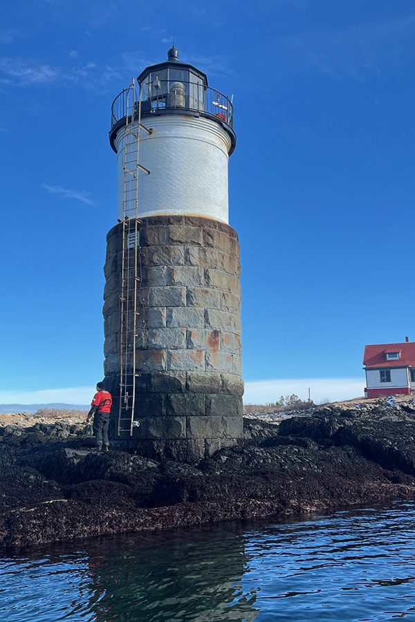
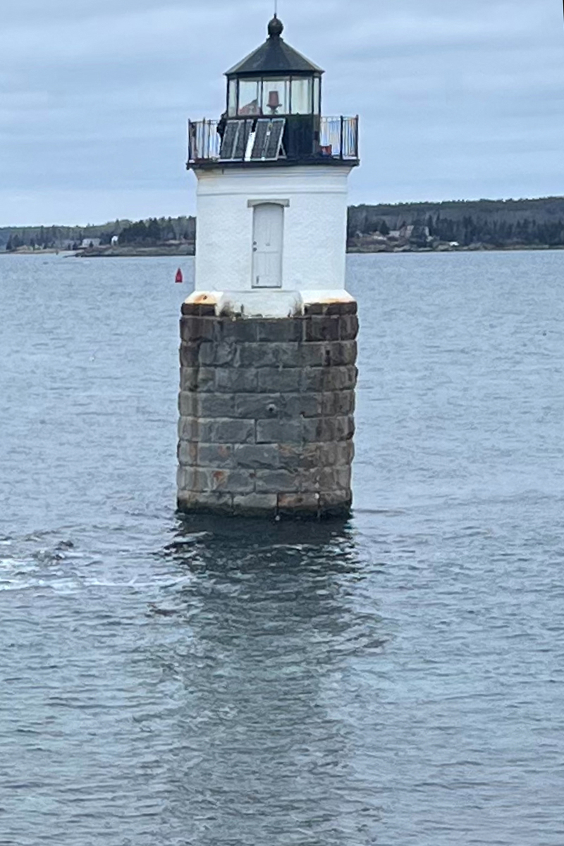
In January 2024, two back-to-back storms caused significant damage along the coast of Maine. In the Boothbay Harbor region, Ram Island Light Station lost its 214 foot walkway that connected the lighthouse to shore. The Coast Guard must now access the lighthouse via a ladder to service the light. They added small solar panels to the lantern deck because the cable to land was severed. Photos Courtesy of Ram Island Trust and U.S.C.G.


What Changes Were Made to the Fog-Signal Over Time?

In this 1896 U.S. Lighthouse Service drawing, the 1,000 pound fog-bell hung off the lighthouse. To activate the striking hammer, the keeper cranked a weight up a drop tube seen attached to the tower. As the weight slowly fell, a clockwork mechanism timed the strikes of one bong every 10 seconds.

Courtesy of the Boothbay Region Historical Society

The white cylinder, located on the tower’s lantern-deck, is a foghorn. Run by electricity from solar panels, this device provides information to mariners during periods of restricted visibility and foul weather – both day and night.
Directions
Ram Island Light Station – Boothbay
The best way to see Ram Island Light is aboard a tour boat from Boothbay Harbor or by land at the end of Linekin Neck in Boothbay, Maine. Follow Route 96 to the end and park near the gravel beach.


